THE PROJECT
Located approximately 50 km south of Pannawonica in the Pilbara Region, the Bungaroo South Development proposed open pits would mine channel-iron deposits (CID) comprising tertiary-aged alluvium, clayey sands and hardcap CID over an estimated 15-year life. The magnetite ore would be trucked along a proposed 200 km sealed haul road from the mine to a port development at Cape Preston.
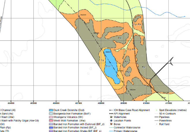
PSM was engaged to assess the geological, engineering and geotechnical conditions along three proposed road alignments and develop engineering geological maps of preliminary geotechnical characteristics.
ENGINEERING AND TECHNICAL OPPORTUNITIES
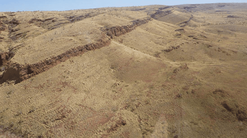
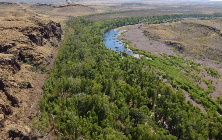
The remote location is subject to high rainfall and events associated with tropical cyclones. There was limited understanding of the geology of this area and geotechnically challenging terrain. This included the rugged Hamersley Ranges which comprise high-strength banded iron formation outcropping in steep hills and gorges.
Engineering and technical opportunities included:
- Potential Karst (sinkhole) terrain, landslides, river crossings and extensive areas of low strength and/or expansive clays (Gilgai) associated with alluvial plains and tidal flats
- High projected equivalent standard axle (ESA) movements over the haul road during the 15 year project life requiring careful pavement design, subgrade preparation and/or modification, pavement material selection, and construction techniques
- Heritage restrictions precluding ground breaking in the initial project phases.
APPROACH AND INNOVATION
Following rigorous assessment and modelling, PSM’s tailored approach included:
- Staged assessment and provision of preliminary geotechnical design advice based on PSM’s experience in similar geological settings to reduce costs
- Preliminary assessment of feasibility comprising a desktop study, a helicopter flyover, publicly available GIS data and previous engineering experience of the region to select route, geological conditions and geotechnical design parameters
- Development of geotechnical understanding of rock mass properties through staged laboratory testing in parallel to the field investigation to shorten project duration
- Provision of engineering geological mapping to provide definition of geotechnical boundaries and regional structural data without the need for groundbreaking investigation.
OUTCOMES
PSM’s staged approach to geotechnical mining solutions maximised the delivery of important geotechnical advice and minimised design cost to the client.
Services: #Geotechnical #hamersleyranges #irondeposits #openpit #pannawonica #Pilbara #westernaustralia